

In our rapidly evolving world, deforestation remains a critical environmental issue. Trees are disappearing at an alarming rate, leading to devastating consequences for biodiversity, climate, and human livelihoods. But hope is on the horizon, quite literally. With the advent of satellite data, we have a powerful tool to monitor and combat deforestation from space.
This blog post will explore how satellite technology is revolutionizing environmental monitoring and why it’s crucial for activists and tech enthusiasts alike.
Understanding the Gravity of Deforestation
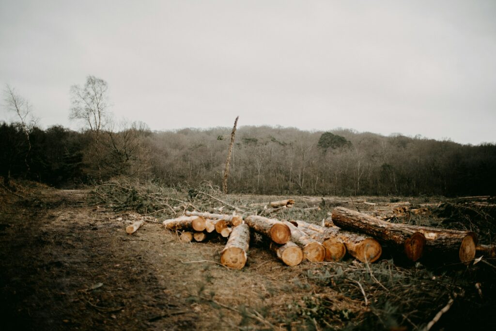
Deforestation involves the large-scale clearing of trees, typically for agriculture, logging, or urban development. The impacts are far-reaching, from loss of habitat for countless species to increased greenhouse gas emissions. Forests act as carbon sinks, absorbing CO2 from the atmosphere. When they’re cut down, not only is this absorption capacity reduced, but the stored carbon is released back into the air, exacerbating climate change.
However, tracking deforestation on the ground is challenging due to the vast and often remote areas involved. This is where satellite data comes into play.
The Magic Behind Satellite Data
Satellite data is collected by sensors mounted on satellites orbiting the Earth. These sensors capture images of the planet’s surface, which are then transmitted back to ground stations. The data is processed to create detailed maps and images, providing a bird’s-eye view of our planet.
There are various types of satellite sensors used in environmental monitoring, including optical sensors that capture visible light and radar sensors that can see through clouds and darkness. Each type has its unique advantages, making satellite data a versatile tool for detecting deforestation.
How Satellites Detect Deforestation
Satellite imagery allows us to detect changes in land cover over time. By comparing images taken at different times, we can identify areas where trees have been cleared. This process involves sophisticated data analysis and interpretation.
For instance, the Amazon rainforest, one of the most significant deforestation hotspots, is closely monitored using satellite data. Images captured by NASA’s Landsat satellites reveal how large swathes of forest are being transformed into agricultural land. These images are analyzed to measure the extent of deforestation and its impact on the ecosystem.
Similar techniques are used worldwide. In Southeast Asia, satellite data helps track illegal logging activities in protected areas, while in Africa, it aids in monitoring the encroachment of human settlements into wildlife habitats.
The Perks and Pitfalls of Satellite Monitoring
Using satellite data for deforestation monitoring offers several benefits. First, it provides comprehensive coverage of large areas, including remote and inaccessible regions. Second, it allows for continuous monitoring, enabling timely detection of deforestation activities. Third, satellite data is objective and can be used as evidence in enforcing environmental laws and policies.
However, there are challenges too. The accuracy of satellite data can be affected by cloud cover, which obstructs the view of optical sensors. Additionally, interpreting satellite images requires specialized skills and technology, which may not be readily available in all regions.
The Tech That Makes It Possible
Technological advancements in satellite monitoring have significantly enhanced our ability to detect deforestation. High-resolution satellites now provide images with greater detail, allowing for more precise mapping of forest cover.
Satellite data is also becoming more accessible. Platforms like Google Earth Engine offer powerful tools for analyzing satellite imagery, making it easier for researchers and activists to monitor deforestation in real-time. The integration of machine learning algorithms further improves the accuracy and efficiency of data analysis.
Looking ahead, the future of satellite monitoring looks promising. Innovations such as hyperspectral imaging, which captures a wide range of wavelengths, can provide even more detailed information about the composition and health of forests. Additionally, the launch of new satellites with advanced sensors will continue to enhance our monitoring capabilities.
From Data to Action
The information gathered from satellite data is invaluable for driving environmental policies and initiatives. Governments and organizations use this data to develop strategies for sustainable land use, enforce anti-deforestation laws, and protect endangered ecosystems.
For example, Brazil has implemented the DETER system, which uses satellite data to detect and report deforestation in the Amazon. This information is used to guide enforcement actions and allocate resources for forest conservation. Similarly, in Indonesia, satellite data helps monitor palm oil plantations’ compliance with environmental regulations.
But it’s not just about policies. Individuals can also make a difference. By supporting sustainable practices and being conscious of our consumption choices, we can contribute to the fight against deforestation. Whether it’s buying products with sustainably sourced materials or advocating for stronger environmental protections, every action counts.
Wrapping Up
Satellite data is a game-changer in the battle against deforestation. It provides a powerful tool for monitoring forest cover, detecting illegal activities, and informing policy decisions. For environmental activists and tech enthusiasts, understanding and leveraging this technology is crucial in our collective effort to protect our planet.
In conclusion, the role of satellite technology in environmental monitoring cannot be overstated. It represents a marriage of science and activism, offering hope for a more sustainable future. As we continue to innovate and improve these technologies, the possibilities for positive impact are endless.
For those passionate about environmental protection, we encourage you to explore further and get involved. By staying informed and taking action, we can make a real difference. Let’s work together to ensure that our forests, and the life they support, thrive for generations to come.